Showing posts with label UNESCO. Show all posts

Saturday, April 21, 2018

Arlington Street Church - ASC Tiffany Education Center


The Arlington Street Church is a Unitarian Universalist church across from the Public Garden in Boston, Massachusetts. Because of its geographic prominence and the notable ministers who have served the congregation, the church is considered to be among the most historically important in American Unitarianism and Unitarian Universalism. Completed in 1861, it was designed by Arthur Gilman and Gridley James Fox Bryant to resemble James Gibbs' St. Martin-in-the-Fields in London.


In the 1960s, the congregation became active in the Civil Rights Movement. James Reeb, a minister active in the congregation, was murdered during a march in Selma, Alabama. Under the ministry of Jack Mendelsohn, the church became a center for protests against the Vietnam War. In the 1980s, the church led AIDS awareness programs and support for the homeless.

The main sanctuary space has 16 large-scale stained-glass windows installed by Tiffany Studios from 1899 to 1929. Originally, all of the sanctuary windows were glazed with clear glass. In 1898, the congregation voted to start installation of memorial stained glass windows created by the studios of Louis C. Tiffany, and commissioned a set of designs for all 20 windows. The last of 16 Tiffany windows was installed in 1929, just before the Great Depression dried up available funds. By the time the economic crisis had eased, Tiffany Studios had been liquidated (in 1937), and new Tiffany windows were unobtainable.


The Tiffany windows were designed by Frederick Wilson (1858–1932), Tiffany's chief designer for ecclesiastical windows. He made extensive use of Tiffany's special glassmaking technologies, including confetti glass, iridescent glass, 3D-textured "drapery glass", pastel colors for "painting in glass", and the trademark opalescent “Favrile” glass. There are as many as six or seven layers of glass in a Tiffany window, producing visual textures that would otherwise have to be painted in. Only some fine details impractical to produce in glass were hand-painted, in permanent enamel.

Sunday, October 09, 2016

Minuteman National Park


At Minute Man National Historical Park the opening battle of the Revolution is brought to life as visitors explore the battlefields and structures associated with April 19, 1775, and witness the American revolutionary spirit through the writings of the Concord authors.


Saturday, May 28, 2016

Obama Hiroshima Ceremony and Speech


Barack Obama became the first sitting U.S. president to visit the site of the Hiroshima atomic bombing. 

Some 140,000 people were killed when the U.S. dropped an atomic bomb on the city on Aug. 6, 1945.

Obama called for a world without nuclear weapons after visiting Hiroshima Peace Park Memorial, where he spent a short time in the site's museum and then solemnly placed a wreath at the arched monument.

Wednesday, January 29, 2014

Shirakawa-go - Gifu, Prefecture Japan


The Historic Villages of Shirakawa-gō and Gokayama are one of Japan's UNESCO World Heritage Sites. The site is located in the Shirakawa river valley stretching across the border of Gifu and Toyama Prefectures in central Japan.

These villages are well known for their houses constructed in the architectural style known as gasshō-zukuri (合掌造り). The Gasshō-zukuri, "prayer-hands construction" style is characterized by a thatched and steeply slanting roof resembling two hands joined in prayer. The design is exceptionally strong and, in combination with the unique properties of the thatching, allow the houses to withstand and shed the weight of the region's heavy snowfalls in winter.

Minka (民家 "house of the people") are houses constructed in any one of several traditional Japanese building styles,  were the dwellings of farmers, artisans, and merchants. Minka are characterized by their basic structure, their roof structure and their roof shape. Minka developed through history with distinctive styles emerging in the Edo period.

Gasshō style roof binding
The houses are large, with three to four stories encompassed between the low eaves, and historically intended to house large extended families and a highly efficient space for a variety of industries. The densely forested mountains of the region still occupy 96% of all land in the area, and prior to the introduction of heavy earth-moving machinery, the narrow bands of flat lands running the length of the river valley limited the area available for agriculture and homestead development. The upper stories of the gasshō houses were usually set aside for silk farming, while the areas below the ground floor were often used for the production of gunpowder.

Pullys used to bind the roof
The primary purpose of shaping minka roofs in this manner was to accommodate the extensive precipitation experienced in many parts of Japan. A steeply peaked roof allows rain and snow to fall straight off it, preventing water from getting through the roof into the home, and to a lesser extent preventing the thatch itself from getting too wet and beginning to rot.


An Ocha-ya (geisha tea house) on the Shirakawa river in the Gion district of Kyoto.
The Shirakawa River is a river flowing into Kyoto prefecture of Japan and a tributary of the Kamo River. Its name means "white river" in Japanese, due to the fine-grained white sand that it carries from the hills east of Kyoto.

Directly before entering the Kamo River, it passes through the geisha district of Gion, where many traditional establishments, such as ocha-ya (geisha tea houses) and restaurants, line the river.


Saturday, August 10, 2013

Angkor Wat, Cambodia


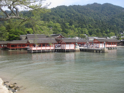
Stretching over some 400 square kilometres, including forested area, Angkor Archaeological Park contains the magnificent remains of several capitals of the Khmer Empire of the 9th to the 15th centuries, including the largest pre-industrial city in the world. The most famous are the Temple of Angkor Wat and, at Angkor Thom, the Bayon Temple with its countless sculptural decorations.


Angkor Archaeological Park was declared a UNESCO World Heritage site in 1992. At the same time, it was also placed on the List of World Heritage in Danger due to looting, a declining water table, and unsustainable tourism. UNESCO has now set up a wide-ranging program to safeguard this symbolic site and its surroundings.


Angkor itself has no accommodations and few facilities; the nearby town of Siem Reap, just 6 km. south, is the tourist hub for the area.

The temples of Angkor are highly symbolic structures. The foremost Hindu concept is the temple-mountain, where the temple is built as a representation of the mythical Mount Meru: this is why so many temples, including Angkor Wat itself, are surrounded by moats, built in a mountain-like pyramidal shape and topped by precisely five towers, representing the five peaks of Mount Meru. The linga (phallus), representing the god Shiva, was also critical and while the lingas themselves have largely gone, linga stands (carved, table-like blocks of stone) can be found in many if not most rooms in the temples. There was also a political element to it all: most kings wanted to build their own state temples to symbolize their kingdom and their rule.


While early Angkor temples were built as Hindu temples, Jayavarman VII converted to Mahayana Buddhism c. 1200 and embarked on a prodigious building spree, building the new capital city of Angkor Thom including Bayon, Ta Prohm, Preah Khan and many more as Buddhist structures. However, his successor Jayavarman VIII returned to Hinduism and embarked on an equally massive spree of destruction, systematically defacing Buddhist images and even crudely altering some to be Hindu again. Hinduism eventually lost out to Buddhism again, but the (few) Buddha images in the temples today are later Theraveda additions.


One element that continues to mystify archaeologists is the baray, or water reservoir, built in a grand scale around Angkor: for example, the West Baray is a mind-boggling 8 km by 2.3 km in size. While it has long been assumed that they were used for irrigation, some historians argue that their primary function was political or religious. Not a single outlet has been found, either by eye or by NASA imaging. The moat around Angkor and the West Baray still contains water, but the rest have dried up.


Ankor Wat Located six kilometre north of Siem Reap, Angkor Wat is one of the largest of Khmer monuments. Built around the first half of 12th century by King Suryavarman II, the temple's balance, composition and beauty make it one of the finest monuments in the world.

Though 'Wat' is the Khmer (Cambodian) word for temple, the westward orientation of the structure is atypical of temples. Scholars believe that the architecture and sculptures are that of a temple where Lord Vishnu was worshipped but it was also built as a mausoleum for the king after his death.


Angkor Tom

Built in the latter part of the 12th century by King Jayavarman VII, Bayon is one of the most widely recognised temples in Siem Reap because of the giant stone faces that adorn the towers of Bayon. There are 54 towers of four faces each, totaling 216 faces. There is still a debate as to who is being depicted in the faces. It could be Avalokiteshvara, Mahayana Buddhism's compassionate Bodhisattva, or perhaps a combination of King Jayavarman VII and Buddha.


Ta Prohm Built during the time of king Jayavarman VII and is best known as the temple where trees have been left intertwined with the stonework, much as it was uncovered from the jungle. It might be considered in a state of disrepair but there is a strange beauty in the marvelous strangler fig trees which provide a stunning display of the embrace between nature and the human handiwork. 

This is one of the most popular temples after Angkor Wat and the Bayon because of the beautiful combinations of wood and stone. Black and white film photographers especially love this site because of this and most of the stunning postcard shots of Angkor's trees come from here; pop culture fans, on the other hand, may recognise a few scenes from Angelina Jolie's Tomb Raider. 

While the temple is very popular, most visitors follow a central route and the sides of the complex can be surprisingly quiet. Note that large sections of the temple are unstable rubble and have been cordoned off, as they are in real danger of collapse. As of 2010, authorities have started to restore Ta Prohm. All the plants and shrubs have been cleared from the site and some of trees are also getting removed. A crane has been erected and a large amount of building work is underway to rebuild the temple, much of it seemingly from scratch. Wooden walkways now block some of the previously famous postcard photos. People that want to take a pretty picture of a building overgrown by a huge tree without the crowds, walkways, cranes etc. might want to check out the gatehouse in the back of the Ta Som complex instead.

Tuesday, May 21, 2013

Hiroshima Peace Memorial Museum


The Hiroshima Peace Memorial Museum collects and displays the belongings left by the victims, photos, and other materials that convey the horror of the world's first atomic bombing of populated area on August 6, 1945.

Atomic (Genbaku) Dome
The Hiroshima Peace Memorial (Genbaku Dome) was the only structure left standing in the area where the first atomic bomb exploded on 6 August 1945. The building was the only one left standing near the epicenter of the bomb blast, albeit in skeletal form.


Through the efforts of many people, including those of the city of Hiroshima, the build has been preserved in the same state as immediately after the bombing. Not only is it a stark and powerful symbol of the most destructive force ever created by humankind; it also expresses the hope for world peace and the ultimate elimination of all nuclear weapons.


The Peace Memorial Park, in which the Dome is the principal landmark, was laid out between 1950 and 1964. The Peace Memorial Museum in the Park was opened in 1955. Since 1952 the Park has been the scene of the Hiroshima Peace Memorial Ceremony, held annually on 6 August.


The Hiroshima Peace Memorial is a stark and powerful symbol of the achievement of world peace for more than half a century following the unleashing of the most destructive force ever created by humanity. It was preserved in that state when reconstruction of the city began. In 1966 the Hiroshima City Council adopted a resolution that the Atomic Bomb Dome should be preserved in Perpetuity.

Monday, May 20, 2013

Itsukushima - Miyajima, Hatsukaichi - Hiroshima, Japan


Itsukushima is an island in the western part of the Inland Sea of Japan, located in the northwest of Hiroshima Bay. It is popularly known as Miyajima the Shrine Island, best known for its famous "floating" O-torii gate. The shrine complex is listed as a UNESCO World Heritage Site and the Japanese government has designated several buildings and possessions as National Treasures. The area designated for World Heritage comprises of the 431 hectares including the Itsukushima Shrine, and the adjacent sea, and the Mt Misen Primeval Forest (National Treasure) to the rear.


The O-torii Gate is about 16 meters in height and weighs about 60 tons. The main pillars are 9.9 meters in circumference, and made of natural camphor trees, while the four supporting pillars are made of natural cedar. The present O-torii was erected in 1875, and the eighth since the Heian Period (the last division of classical Japanese history, running from 794 to 1185).

According to records, the shrine was established in the time of Empress Suiko. The warrior-courtier Taira no Kiyomori gave the shrine its present form. In 1555, Mōri Motonari defeated Sue Harukata at the Battle of Miyajima. Toyotomi Hideyoshi built a large building, the Senjō-kaku, on a hill above the shrine.


The first shrine buildings were probably erected in the 6th century, and the shrine has been destroyed many times. The present shrine dates from the mid-16th century, and follows the earlier 12th century design. That design was established in 1168, when funds were provided by the warlord Taira no Kiyomori.


The island of Itsukushima, including the waters around it (part of Seto Inland Sea), are within Setonaikai National Park. This sea is affected by strong tides. At low tide, the bottom of the sea is exposed past the island's O-torii. At high tide, the sea covers all the previously exposed mud and fills areas underneath the shrine.


The Itsukushima Shrine at high tide, when it appears to float on the water. The shrine was designed and built on pier-like structures over the bay so that it would appear to be floating on the water, separate from the sacred island, which could be approached by the devout.


Mt. Misen is the highest peak on Miyajima island, 535 meters above sea level. Since the year 806 it has attracted devout worshipers. The natural environment has been kept intact which creates magnificent scenery.

Mt. Misen Ropeway (unfortunately it was a rainy day)
The Miyajima Ropeway is a network of gondolas that traverse the island, which is rare and unique in Japan and is often described as walking in the sky.

Wait at the ropeway station platform between gondola changes
Kiezu-no-Reikado Hall is located about 20 minutes on foot from Shishiiwa Ropeway Station. The holy fire that Kobo Daishi lit for his ascetic training has been kept burning for over 1,200 years in Reikado Hall. The hall has been designated a "Lover:s Sanctuary" as the flame is akin to the eternal fire of love.

Kiezu-no-Reikado Hall


Monday, March 03, 2008

Gorée Senegal Diaspora


African Diaspora

The African diaspora was the movement of Africans and their descendants to places throughout the world such as the Americas, Europe, Asia, and Australia. Much of the African diaspora is descended from people who were enslaved and shipped to the Americas during the Atlantic slave trade, with the largest percentage sent to Brazil. Brazil obtained 37% of all African slaves traded, and more than 3 million slaves were sent to Brazil.

The Trans Atlantic Slave Trade

The Trans-Atlantic Slave trade resulted in a vast and as yet still unknown loss of life for African captives both in and outside of America. Approximately 8 million Africans were killed during their storage, shipment and initial landing in the New World. The amount of life lost in the actual procurement of slaves remains a mystery but may equal or exceed the amount actually enslaved. If such a figure is to be believed, the total number of deaths would be between 16 and 20 million. Most historians now agree that at least 12 million slaves left the continent between the fifteenth and nineteenth century, but 10 to 20% died on board ships. Thus a figure of 11 million slaves transported to the Americas is the nearest demonstrable figure historians can produce.


Goree Island, Dakar Senegal

Gorée is famous as a former center of the Atlantic slave trade from where many Africans were forcibly departed to the Americas. Gorée is a small island 900 m in length and 350 m in width sheltered by the Cape Vert Peninsula. Now part of the city of Dakar, it served for many centuries as one of the principal factories in the triangular trade between Africa, Europe and the Americas.


The House of Slaves

Gorée is best known as the location of the House of Slaves used as a holding and transfer point during the slave trade. The House of Slaves is one of the oldest houses on the island. The Door of No Return in the House of Slaves is said to be the final exit point of the slaves from Africa.


The House of Slaves is powerful, not because millions of slaves actually left through The Door of No Return, but because Africa's descendants have made this their place to honor them.


Descendent's of the Gorée Diaspora

The slaves from Gorée were destined essentially to the French colonies in the Caribbean (prominently Haiti) and in Louisiana, as well as to the Spanish colonies (Cuba essentially) and to the Portuguese colonies in Brazil. Very few African Americans from the U.S. have ancestors who went through Gorée, as the English colonists had other sources of "import" for their slaves. Those who can with most certainty consider Gorée as a transit point for their ancestors are the African Americans whose family are from the south of Louisiana, some of which actually still speak some sort of French. As African Americans have migrated a lot throughout the US in the last 100 years, it can be difficult to know with certainty which families were originally from French Louisiana.